Great Tips About Does Mysql Support Spatial Data

Exploring MySQL's Spatial Capabilities: A Deep Dive for Developers
Unveiling the Geographic Dimensions of Your Database
Ever needed to keep track of places and locations within your MySQL setup? Maybe you're crafting a map-based app, a directory of local businesses, or even a system to see where deliveries are going. If that sounds like you, then you've probably wondered if MySQL can handle geographical data. Well, good news! It absolutely can. MySQL has some strong features for dealing with location-based information, letting you do some pretty clever spatial analysis right inside your database.
This ability really opens things up. It's not just about storing simple latitude and longitude numbers. Imagine being able to find all the coffee shops within a few miles of someone, see all the customers inside a specific area on a map, or even figure out the distance between two spots on Earth. MySQL's spatial add-ons make these kinds of things not just possible, but also surprisingly efficient.
So, how does MySQL pull off this geographical trickery? It uses a set of data types and functions that are based on the standards set by the Open Geospatial Consortium (OGC), a group that works on making geospatial data work together better. Because it follows these standards, MySQL can work with other geospatial tools and libraries, making it a really useful option for apps that need to know about locations.
Think of it as giving your database a special pair of eyes that can "see" the world in terms of dots, lines, and shapes. This "vision" lets you ask some detailed questions about locations and get back answers that really make geographical sense.
Delving into MySQL's Spatial Data Types
Understanding the Building Blocks of Geographic Information
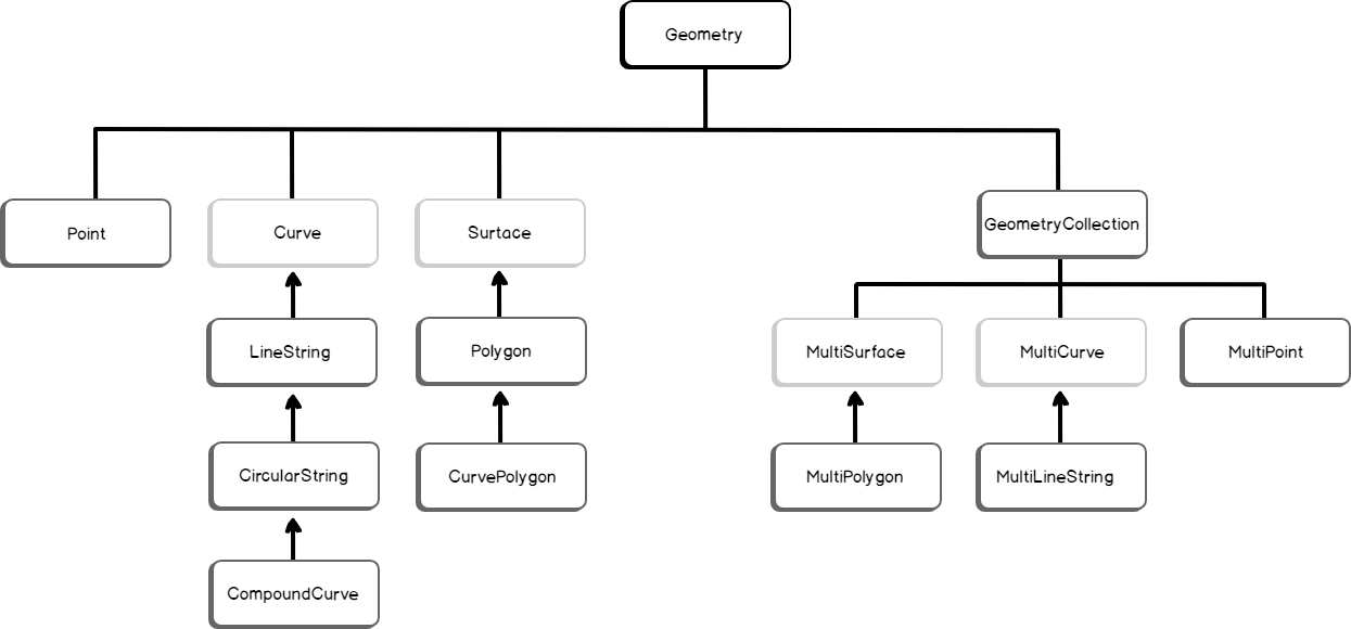
To really get to grips with spatial data in MySQL, it's important to understand the basic types of data it offers. These types represent different shapes and features in the real world, helping you accurately model things that have a location. The main spatial data types in MySQL include POINT, LINESTRING, POLYGON, MULTIPOINT, MULTILINESTRING, and MULTIPOLYGON.
A POINT is just what it sounds like — a single spot in space, defined by its coordinates (usually latitude and longitude). A LINESTRING is a series of points connected by straight lines, useful for things like roads, rivers, or flight paths. POLYGONs define areas enclosed by one or more rings (a ring is a closed LINESTRING), perfect for showing things like city limits, land areas, or the shape of buildings.
The "MULTI" versions (MULTIPOINT, MULTILINESTRING, and MULTIPOLYGON) let you store collections of these basic shapes all in one database entry. This is really handy when you're dealing with things that have multiple separate parts, like a group of islands (MULTIPOLYGON) or a set of related points of interest (MULTIPOINT).
Choosing the right spatial data type is key for storing things efficiently and making queries faster. Picking the most specific type for your data not only saves space but also lets you use all the powerful spatial functions MySQL offers for accurate analysis.
Harnessing the Power of Spatial Functions in MySQL
Performing Geographic Operations with Ease
The real magic of MySQL's spatial support comes from its wide range of spatial functions. These functions let you do all sorts of things with your location data, from simple calculations to complex shape analysis. Whether you need to know if a spot is inside a certain area, calculate how far apart two places are, or find where two areas overlap, MySQL has tools for that.
Some commonly used spatial functions include ST_Distance() to find the shortest distance between two shapes, ST_Contains() to check if one shape completely includes another, ST_Intersects() to see if two shapes have any common ground, and ST_Buffer() to create a zone around a shape. And these are just a few examples; MySQL has a whole toolbox of functions to work with and understand spatial data.
You usually use these functions inside your regular SQL queries, which means you can easily add spatial analysis to how you get and work with your data. For example, you could use ST_Distance() to find all locations within a certain distance of a specific point, or use ST_Contains() to filter results based on whether they fall within a particular administrative boundary.
Getting comfortable with these spatial functions is the key to really using MySQL for location-based applications. They empower you to ask smart questions about your data and get back geographically relevant information quickly and effectively.
Indexing Spatial Data for Optimal Performance
Boosting Query Speed for Location-Based Searches
When you're dealing with lots of data that includes locations, how fast things run becomes really important. If you don't set up your database correctly, asking questions about spatial data can take a long time. Luckily, MySQL has ways to make these kinds of searches much faster by using spatial indexes.
You usually create spatial indexes in MySQL using the SPATIAL keyword when you're defining an index on a column that holds spatial data. This type of index is specifically designed to efficiently search and find spatial data based on its geometric properties. Unlike regular indexes that work well for simple numbers and text, spatial indexes use special structures, like R-trees, to handle the complexities of shapes and their relationships.
Creating a spatial index on your location-based columns can really speed up queries that use spatial functions in their search conditions. For example, a query that uses ST_Intersects() to find all features that overlap with a given area will run much faster if there's a spatial index on the column holding the geographic data.
Think of a spatial index as a super-organized map that helps MySQL quickly find and retrieve location data that matches what you're looking for, without having to look at every single entry in the table. This optimization is crucial for building apps that are responsive and can handle a lot of location-based information.
Practical Applications and Real-World Examples
Seeing Spatial MySQL in Action
The ways you can use MySQL's spatial features are really diverse and pop up in many different industries. Think about a ride-sharing app that uses location data to find drivers nearby and figure out the best routes. Or consider a real estate website that lets people search for properties within specific geographical areas and see them on a map. These are just a couple of examples of how spatial MySQL powers real-world applications.
Local search features, like finding nearby restaurants or shops, heavily rely on spatial data to show you things close to your current location. Logistics and delivery companies use spatial data for planning routes, tracking their vehicles, and managing their operations. Even systems that monitor the environment use spatial databases to store and analyze geographic data about things like pollution, deforestation, or where animals live.
Having spatial capabilities built into a regular database like MySQL has several advantages. It makes managing data simpler by keeping both the details and the location information in one place. It also lets developers use their existing SQL knowledge to do complex spatial analysis without having to learn a whole new geospatial database system.
From online stores offering location-based recommendations to government agencies managing infrastructure, the ability to store, query, and understand spatial data is becoming more and more important. MySQL's strong support for spatial data makes it a great choice for developers looking to build the next generation of apps that understand location.
Frequently Asked Questions (FAQ)
Your Burning Questions Answered
Q: Is MySQL a complete GIS (Geographic Information System)?
A: While MySQL has some impressive spatial features, it's not quite the same as a dedicated GIS like ArcGIS or QGIS. Those systems offer more advanced analysis tools and ways to visualize data. However, for many web-based applications and managing data that needs location awareness, MySQL provides a strong and integrated solution. Think of it as a really useful set of spatial tools within a database you might already know.
Q: What are the usual coordinate systems used with MySQL spatial data?
A: The most common way MySQL handles coordinates is using SRID 0, which is like using a flat grid. However, MySQL also understands other SRIDs, including the very common EPSG:4326 for latitude and longitude on the Earth. It's important to pick the right SRID for your data and make sure you use it consistently throughout your database.
Q: Can I directly see the spatial data stored in MySQL?
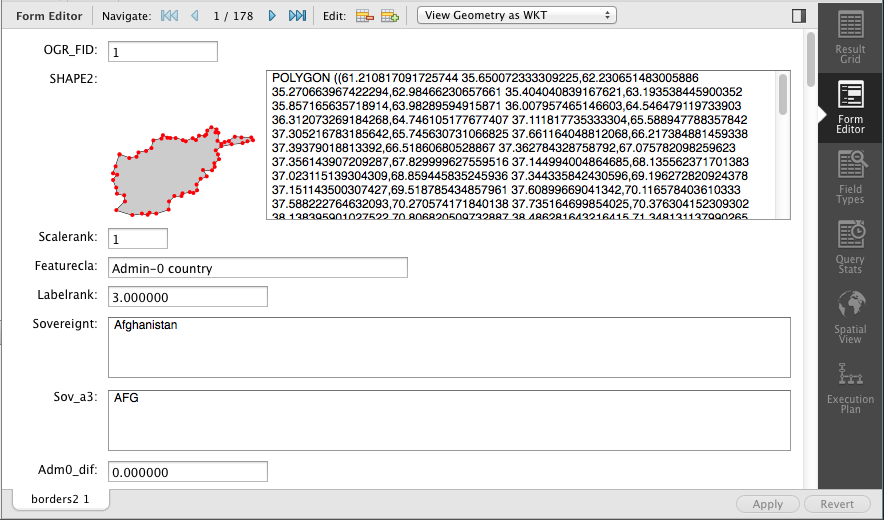
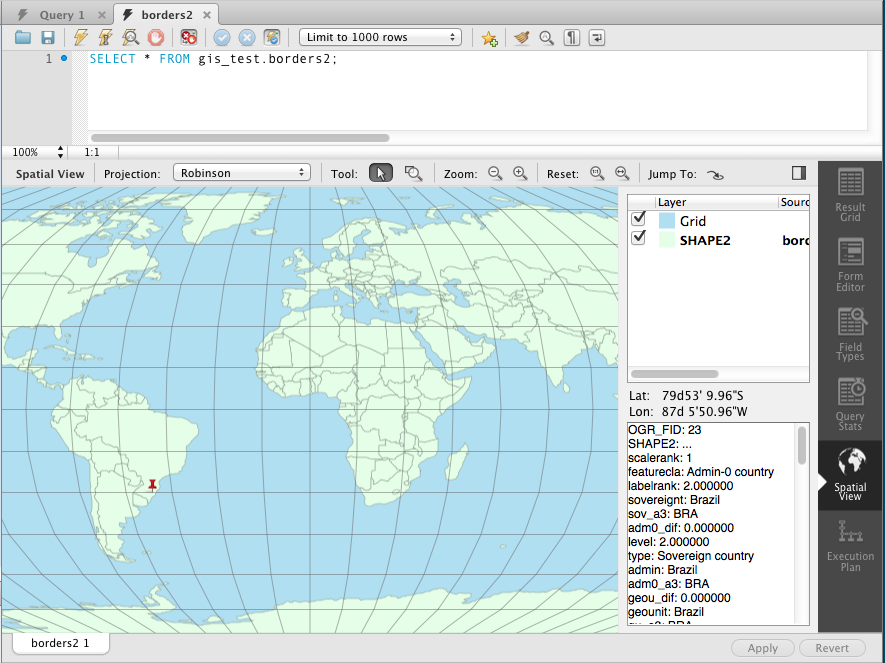
A: MySQL itself doesn't have built-in tools to show you maps or spatial data visually. But, you can easily connect it to various mapping tools and GIS software, like Leaflet, OpenLayers, or QGIS, to see your location data on a map. These tools can talk to your MySQL database and display the geographic information stored inside.


